
Sunday, June 26, 2011
Things are looking up
Thursday, June 23, 2011
Keeping hope alive
I have been in contact with another group of people heading out from Canada this week. I warned them about the severity of conditions in the area, but nonetheless wished them the best of luck. I am hopeful their expedition is successful in making it past where I had to bail out. If so, I am seriously considering meeting up with them in Washington and continuing the trail from there. Safety in numbers right?
Tuesday, June 21, 2011
Manning Park BC

 It occurs to me that I haven't had a good full nights sleep in exactly 7 days. Graduation and endless travel are to blame. I pray my health and sanity holds. The bus to Manning Park was pleasant, rainy, and humbling. The country really is untamed, and man is only a pawn here. The weather keeps switching from Sun to rain, oh well. I hiked about 4 miles exploring the area and will really begin tomorrow. I am excited, but also nervous with doubt. Perhaps I bit off more than I can chew. Only one way to find out what I'm made of though right? Also, I'm the first SOBO of the year, good or bad? Who knows? Dinner in the restaurant then sleep at cold springs camp before early start tomorrow.
 Last 48 hours on the trail


Trail is completely covered by snow, clouds and dense trees make navigation by geological landmarks impossible. Was lost for about 3 hours and backtracked, found trail and started heading the correct direction. Trail gone again, but now I'm going the right way. I'm scared, cold, and very tired. Camped in snow, on ledge, between 2 trees. Supposed to rain tomorrow. I really hope not. Took 1 hour to break camp this morning, cold, not thinking straight. Began walking SSE, no trail. No sign of trail all day. Made it to Hopkin's pass, then trouble.

Fog came down to about 4000 feet, I'm at 6000 feet. Sat down and cried and prayed for the weather to get better. Not sure where I am, gave it 2 hours to improve. I'm very scared, dont want to continue in the wrong direction and die. 9:30 weather got worse, I called 911. Sat down again and prayed, a lot. Weather so bad I don't know if helicopter can fly. All I think about is Kathryn, I wonder if she knows im in trouble, I wonder if she cares. Woodpeckers sounds like helicopters. Small avalanches all around. I begin to climb to the ridge to see if conditions are any better, but then a helicopter flies straight over my head. Make for clearer ground to wave red jacket frantically. They see me! I break down and cry, for relief? Embarrassment? Exhaustion? Air lifted out, I get a birds eye view of terrain I was trying to traverse, absolute insanity.


Saturday, June 18, 2011
A new plan
I was stranded at 6000 feet on Hopkins pass yesterday. I decided to bail out after no sign of the trail in 48 hours and deteriorating conditions. The 6 feet of snow I could deal with, it was the lack of visibility that eventually caused my psyche to crack. Less than 40 yards of visibility in white out conditions, with only a map and compass to go by, and I wasn't even sure I was on the right mountain. I am currently in Olympia WA, rethinking my plan. Its raining here, but the city is beautiful. Aside from a bruised ego, I am fine. I have pictures and videos of all the insanity, but no way to upload them, unfortunately. I'll check in again as soon as I can.
Sunday, June 12, 2011
Off I go
My backpack is packed, everything is planned, my house is empty, and I'm ready to go. The train leaves at 12:30 tomorrow afternoon and I'll be completely seperated from anything electronic. To track my progress click the link to the left that says "follow my adventure" to see the latest GPS I have sent. I will be updating this blog as often as possible, and I am no longer on Facebook, so look here for updates and pictures from the trail.
Tuesday, June 7, 2011
First 10 boxes

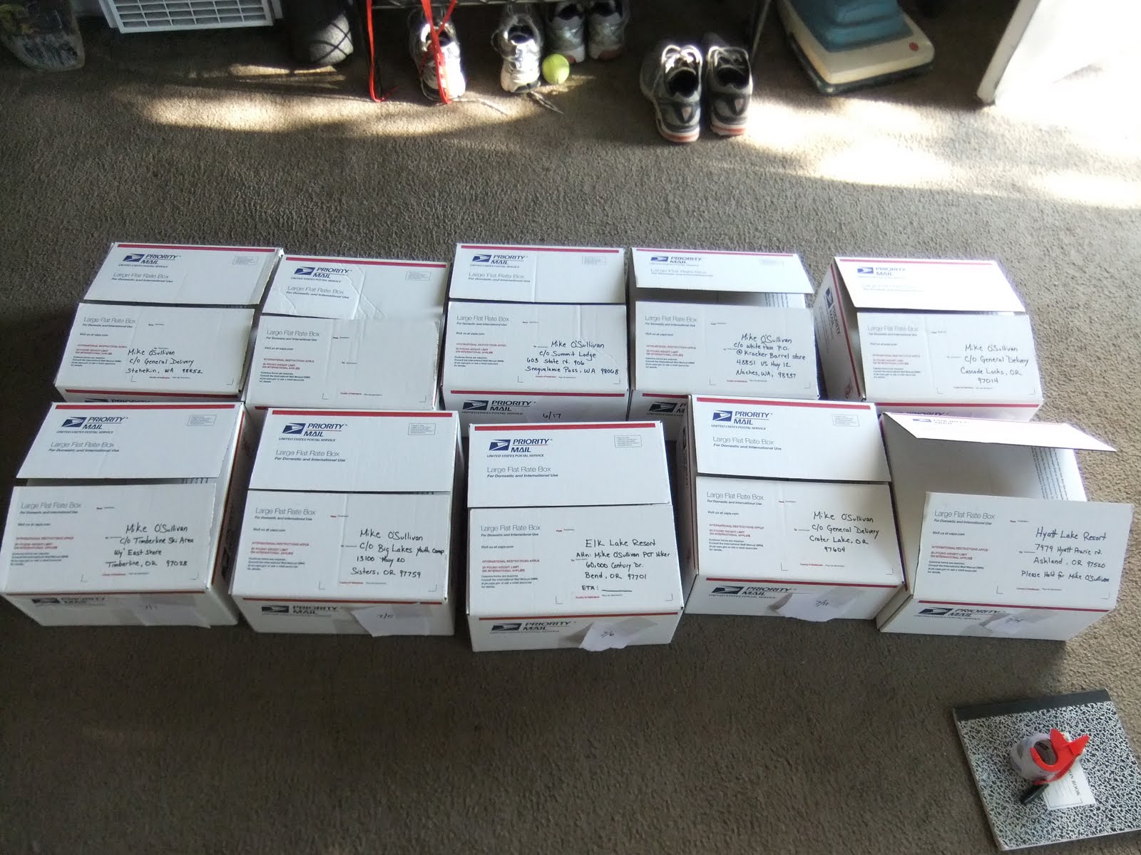 Well it's finals week here at UCSB, and that means lots and lots of time to do things other than study. So naturally I spent most of the week prepping for this hike rather than studying, and I got a good deal done! Every resupply package is done, maps split up, food distributed into 10 boxes, spanning 1000 miles. The heaviest one weighed in at 15 pounds of oatmeal, trailmix, rice, mac n cheese, and various noodles. The lightest weighs less than 5 pounds and will only last for 2 days. The completed packages are all stacked in my living room awaiting their respective shipment dates. The post office will hold packages for 2 weeks before returning them to the sender. Mailing them from southern California 7 days before I am supposed to arrive gives me an approximate 10 day window to pick the package up before it gets shipped home. At no point during this venture should I be that far behind schedule without notification. Countdown to the PCT is at 6 days. All that's left to do is get on the train to Canada on Monday. Then it's just a simple matter of walking home through some of the most remote and rugged terrain on the west coast.
Subscribe to:
Posts (Atom)